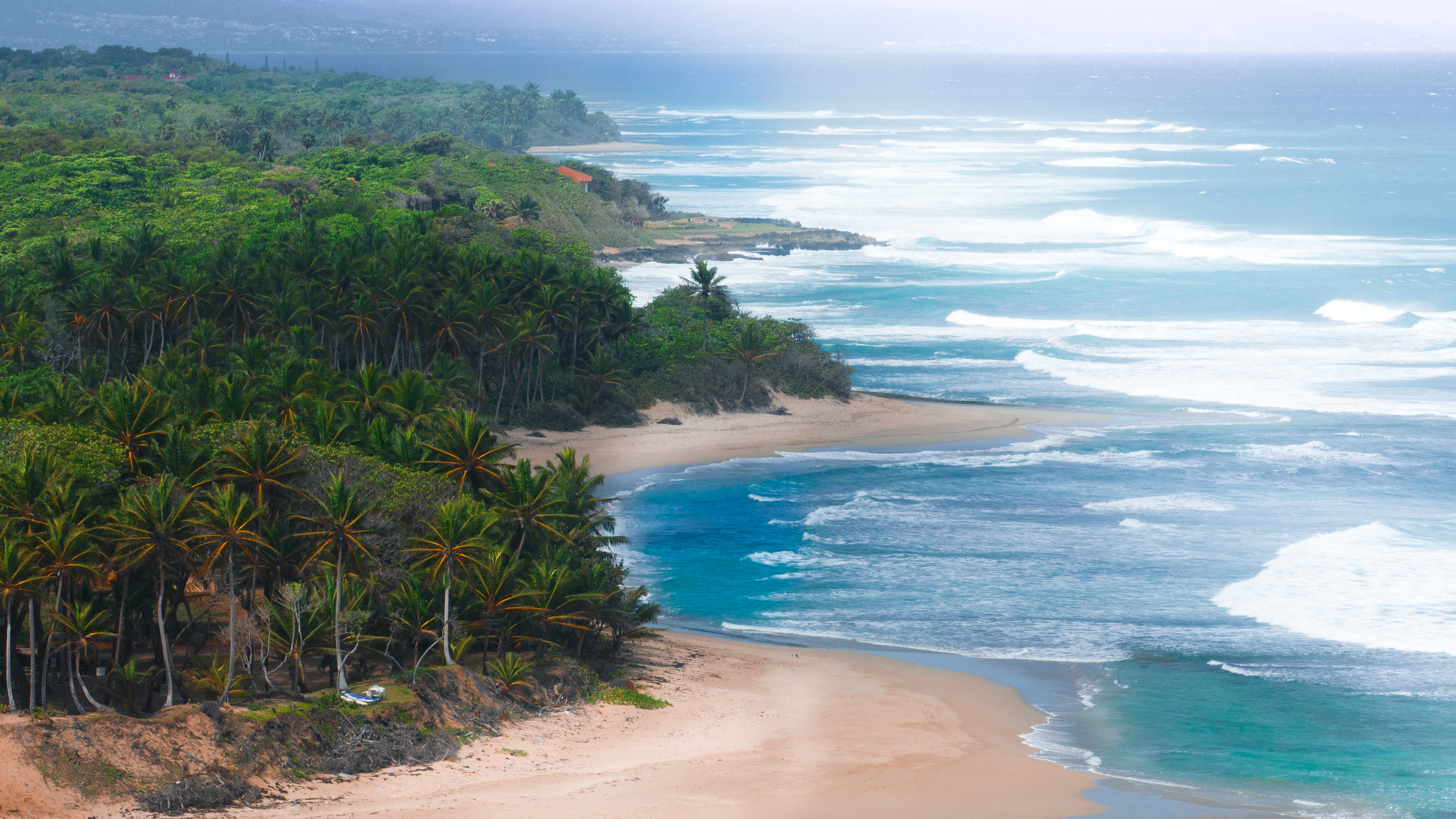
Start with the ordinary weather, because that is what you actually live in. This coast runs between roughly 25 and 31 °C all year, and the sea sits at 25–28 °C — warm enough that nobody here owns a wetsuit. Mornings are typically still and glassy; the trade winds build through the afternoon and drop again in the evening.
There are two loose seasons rather than four. The drier, cooler stretch runs roughly December to April — the most pleasant months, and also the best surf, since North Atlantic swell arrives then. The warmer, wetter stretch runs May to November, when rain tends to come as short heavy showers rather than grey days, often overnight, and the greens get very green.
Which brings us to the question every Caribbean buyer has, usually without saying it out loud: am I buying a hurricane problem? It deserves a straight answer rather than a brochure, so here is one — including the parts that are not flattering.
The honest starting point: the Dominican Republic sits in the Atlantic hurricane belt. The season runs from June to November and peaks between August and October. Nobody on this island pretends otherwise, and any page that tells you a Caribbean coast is hurricane-free is a page worth closing.
What matters is not whether storms exist. It is where they actually arrive — and there the record is unusually clear.
01 · The year, in plain terms
- Air — roughly 25–31 °C year-round; the difference between “winter” and “summer” here is a few degrees and the humidity
- Sea — 25–28 °C, boardshorts twelve months of the year
- Wind — glassy mornings, trades filling in after midday, calm again by evening. It is why the surfers go early and the kiters go late
- Rain — heaviest May and again October–November, usually as short downpours rather than all-day grey
- Best months — December to April: driest, least humid, and the most consistent swell
02 · What 173 years of records show
Every Atlantic hurricane landfall between 1851 and 2024 has been catalogued. Plot them onto Hispaniola and a pattern appears immediately: the landfalls cluster along the southern shore, thin out along the east, and almost disappear along the north.
Hurricane landfalls on the Dominican Republic by coast, 1851–2024. Counted from 173 Years of Hurricane Strikes — Atlantic Basin Hurricane Landfalls, hand-plotted by Michael Ferragamo. The handful of northern landfalls sit toward Samaná in the northeast, not on this stretch of coast.
Over nearly two centuries, the coast between Puerto Plata and Cabarete has taken a direct landfall you could count on one hand. The south coast has taken roughly twenty-five.
03 · How close they have actually come
The landfall count answers where storms arrive on the island. It does not answer the sharper question a buyer is really asking: how close has one ever come to this particular stretch of coast? That is answerable, because NOAA publishes the raw track file — HURDAT2, every six-hourly position and wind speed since 1851 — and anyone can measure it.
So we did. Every Atlantic system that reached hurricane strength within 150 km of this coast, measured at the moment of closest approach:
| Distance | Year | Category | Strength |
|---|---|---|---|
| 34 km | 1896 | 2 | 85 kt |
| 41 km | 1852 | 1 | 80 kt |
| 43 km | 1899 | 3 | 105 kt |
| 47 km | 1928 | 4 | 135 kt |
| 49 km | 1908 | 1 | 65 kt |
| 60 km | 2022 | 2 | Fiona, 95 kt |
| 106 km | 2017 | 5 | Irma, 145 kt |
| 125 km | 2017 | 3 | Maria, 110 kt |
The closest any hurricane has come in 174 years of records is 34 km, in 1896. Nothing at hurricane strength has ever entered the 25 km ring. And the pattern in the chart is the argument: nineteen of the twenty-four passed to the north, out over open water, rather than over the coast.
04 · Why the north gets missed
It is geography, not luck. Atlantic systems form off Africa and track west and north-west across the basin. By the time they reach Hispaniola they are approaching from the south-east, so the first land they meet is the southern shore. That is where Georges came ashore in 1998, where David hit in 1979, where Flora, Inez, Gustav and Matthew arrived.
Behind this coast the land rises twice. First the Cordillera Septentrional, a range running parallel to the shore that reaches about 1,250 m at Diego de Ocampo — Isabel de Torres above Puerto Plata is 799 m. Behind that sits the Cordillera Central, which holds Pico Duarte at 3,098 m, the highest point in the Caribbean. A storm crossing the island has to climb both, and mountains take a hurricane apart quickly: the warm ocean feeding it is gone, dry air pours in, and the structure collapses.
Sailors have a shorter version of the same thing. A storm passing north of a mountainous island gives the north coast its weaker southern flank. A storm crossing the island over land arrives already broken. It takes an unusual track to give this coast the worst of a system, and the record shows how rarely that track occurs.
There is a third, smaller factor worth naming honestly, because you will see it overstated elsewhere. Storms on the northern hemisphere drift slightly right of the wind that steers them — an effect called beta drift, caused by the Earth's rotation varying with latitude. It nudges westward-moving systems poleward. But the upper-level steering pattern drives most of any given track, so beta drift is one contributing factor, not the reason. And it cuts both ways: what passes to the north passes close enough to send swell.
The part that is not flattering
A landfall in the south is still a storm on the island. Georges in 1998 crossed Hispaniola and caused serious damage nationwide, the north included. The record also holds close calls: a hurricane passed 52 km north in 1926 and killed people in Puerto Plata, and 1928 brought a Category 4 within 47 km. No recorded direct landfall is not the same as no weather. It means this coast has consistently been on the sheltered side of a system rather than in its path — a meaningful difference, not an exemption.
05 · The reef does most of the work
The most useful thing in front of this land is not on any legal document. It is the reef — the same shallow rock that makes the surf breaks work.
A reef is a wave-energy filter. When a swell reaches shallow water it trips and breaks, and it spends its energy there rather than on the shore behind it. The effect is large and it is measured: a meta-analysis in Nature Communications found that coral reefs dissipate on average 97 % of incoming wave energy, with 86 % of that lost at the reef crest alone — the shallowest band, where the wave first stands up. USGS and The Nature Conservancy cite the same figures and compare healthy reefs directly to engineered breakwaters.
What that looks like from the land
On a big day you can watch the mechanism work. Heavy surf detonates on the reef several hundred metres out, and the water between the reef and the rock at the shoreline stays comparatively flat. That is not calm weather — it is several hundred metres of shallow limestone taking the hit first. The same feature that makes eight waves break below this land is the feature that keeps the swell off the shoreline.
The shoreline itself is rock rather than sand — an uplifted fossil-reef platform, the geology this coast is built on. Rock does not migrate the way a sand beach does in a big swell. We are having the elevation surveyed so this stops being a description and becomes a number.
06 · Why people here look forward to it
Ask anyone who surfs this coast what they make of hurricane season, and the answer tends to surprise people from colder places: they look forward to it.
Not to the storms themselves — nobody here wishes a hurricane on anyone, least of all on the islands that take the hit. But to what a distant system sends ahead of itself. When something spins up far out in the Atlantic, the group chats on this coast fill with swell charts rather than worry. Boards get waxed. Alarms get set earlier. People take days off.
Here is the turn in the story. The systems that pass to the north of the island — the ones that never come close enough to threaten anything — send their energy ahead of them as swell. That swell is the reason this coast surfs.
It is the same physics that makes a hurricane dangerous somewhere else and makes a wave here. A storm sitting hundreds of miles out in the Atlantic pushes long-period groundswell toward Hispaniola’s north-facing reefs, and two days later the breaks in front of this land are working. Locals watch the tropical forecast the way skiers watch snow reports.
The winter season works the same way with North Atlantic lows rather than tropical systems: storms far away, waves here, sunshine overhead. October to April is the prime stretch, and it overlaps almost exactly with the tail of hurricane season.
The bit outsiders find strange
The best waves of the year arrive in the window people elsewhere are told to fear: September through November, while tropical systems are still turning out in the Atlantic. A storm a thousand miles away, sunshine directly overhead, and the reef in front of this land doing something it simply does not do in July.
That is not spin. It is why surfers moved to this coast in the first place.
07 · How people build here
Caribbean construction long ago stopped pretending storms are hypothetical. What is standard on this coast:
- Reinforced concrete, walls and roof slab — not timber frame. It is the default, not an upgrade
- Poured concrete roofs rather than sheet material, which is what actually fails in high wind
- Shuttered or impact-rated openings, and covered outdoor space designed to be cleared quickly
- Cisterns and independent water — required in Sol de Plata anyway, and exactly what you want when public supply drops
- Generators, near-universal here for the same reason
Anything built to those standards on this coast is built for far worse than it will typically see.
08 · What a buyer should actually do
- Ask about elevation and how the ground sits relative to the water. Rock and elevation behave very differently from low sand in a storm surge
- Budget for proper construction from the start — concrete, a poured roof, shutters. Doing it later costs multiples
- Get a quote for insurance early. It is available and it is priced on construction type; a concrete house on high ground is a different risk from a beach cabana
- Plan building work around the season. Pouring concrete in October is a decision, not an accident
- Read the actual record rather than the general reputation of “the Caribbean”. It varies enormously coast to coast, and the difference is worth real money
In short
The Dominican Republic is in the hurricane belt, and it would be dishonest to say otherwise. But in 173 years of records, the coast this land sits on has taken a direct hit you could count on one hand, while the south of the island has taken around twenty-five. What arrives here from those distant storms is usually swell.
This page is orientation, not risk advice. Landfall counts are read from the published record cited above; weather is not a guarantee and no coast is exempt. Speak to your own insurer, engineer and attorney before making decisions that depend on any of it.
Sources
NOAA HURDAT2 — Atlantic hurricane database, 1851–2024. Every figure in section 03 is measured from this file. aoml.noaa.gov
Ferrario et al., Nature Communications 5, 2014 — “The effectiveness of coral reefs for coastal hazard risk reduction and adaptation”. nature.com
USGS — Coral reefs as natural coastal defence. usgs.gov
NOAA Historical Hurricane Tracks — Check any storm, any radius, yourself. coast.noaa.gov
Every number on this page comes from a public source you can open. We would rather you checked.